Danbury, Connecticut: Hat City History, Rail Heritage, and Where to Eat
Danbury, Connecticut
Part of The Burys of Connecticut
Pictures from Danbury
See all 5 photos →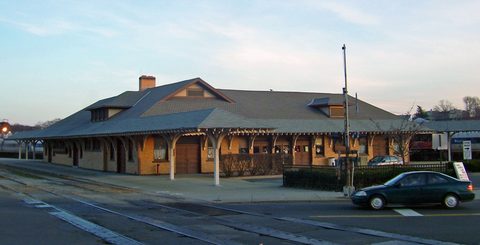
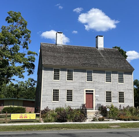
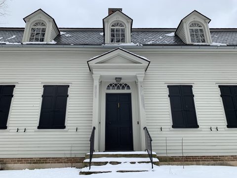
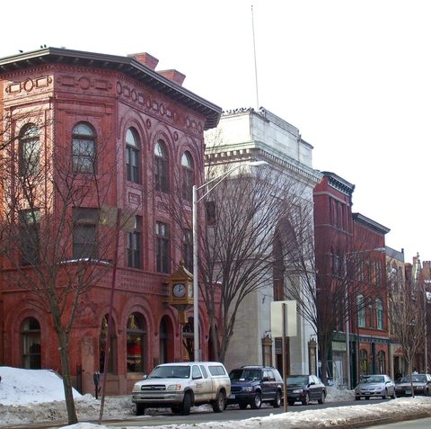
Danbury made America's hats. From Zadoc Benedict's first felt hats in the late 1700s to roughly 4.5 million hats a year by 1880, "Hat City" crowned the country — and paid for it with the mercury-poisoning tremors known as the Danbury Shakes, a story that ends with Connecticut banning mercury from hatting in 1941. Today the city wears its history well: a seven-building museum campus with the birthplace of composer Charles Ives, a railroad museum in the restored 1903 Union Station, a 722-acre park around a Gilded Age mansion, and one of the state's best brewery taprooms. It's the natural base for exploring western Connecticut.
-
sight
A working rail yard of 60-plus historic pieces around the restored 1903 Union Station. Weekends 10-4, $10 — time it for a train-ride day, spring through October.
-
Seven historic buildings on Main Street, including the Charles Ives Birthplace and the Marian Anderson Studio — and the definitive Hat City story. Tours Wednesday-Saturday.
-
sight
722 acres, 21 miles of trails, and the 1897 Tarrywile Mansion. Dawn to dusk, free.
-
sight
The Main Street venue hosting music, comedy, theater, and film.
-
Twelve-inch pies from an 800-degree Italian oven, sourced from Connecticut and New York growers.
-
food
76 wing flavors and roughly 50 beers, and an official soccer chapter bar.
-
Hand-cut Midwestern steaks and a salad bar included with meals; live music Tuesdays and Thursdays.
-
food
Ten rotating draft lines, food trucks, and a biergarten on Shelter Rock Road.
-
stay
The boutique pick, with Terra Danbury (Northern Italian) on site.
-
The dependable mid-range pick on Newtown Road — pool, gym, free breakfast, EV charging.
Hat City: how Danbury crowned America
Before hats, Danbury was "Beantown" — named in 1687, incorporated in 1702, and known for its bean crops. Zadoc Benedict changed that in the late 18th century with felt hat-making; by 1809 there were 56 hat shops, and by the 1850s Danbury called itself the Hat City of the World, with hatting employing more residents than every other occupation combined. The price was steep: mercury nitrate used in felt "carroting" caused the tremors known as the Danbury Shakes — a 1922 study found 43 of 100 examined union hatters showed mercury poisoning. On December 1, 1941, Connecticut banned mercury in hat manufacturing, a date Danbury hatters celebrated annually. The industry faded — six manufacturers by 1923, one by the 1950s — but the Danbury Museum keeps the whole story.
The Revolution came here
Danbury was a Continental Army supply depot, and in April 1777 British forces under Major General William Tryon raided and burned the town — one of Connecticut's defining Revolutionary episodes. The Danbury Museum's historic buildings, including the John Rider House, put you in that streetscape.
Getting there
Danbury sits on I-84 at the New York line, with its own Metro-North branch line. The Railway Museum is right at the old Union Station on White Street; downtown Main Street and the museum campus are minutes away.
Frequently asked questions
- Why is Danbury called Hat City?
- It was the center of American hat production — 56 hat shops by 1809 and roughly 4.5 million hats a year by 1880; by the 1850s it styled itself the 'Hat City of the World.'
- What were the Danbury Shakes?
- Tremors from mercury poisoning among hatters, caused by the mercury nitrate used in felt-making. Connecticut banned mercury in hat manufacturing on December 1, 1941.
- When is the Danbury Railway Museum open?
- Weekends 10 AM-4 PM, admission $10 for ages 3+, with train rides from early spring through October plus December Santa trains.
- Where should I stay in Danbury?
- Hotel Zero Degrees is the boutique option; La Quinta by Wyndham on Newtown Road is the reliable mid-range one. The historic Ethan Allen Hotel also operates in town.
- What happened in Danbury in 1777?
- British forces under Major General William Tryon raided and burned the town, which was serving as a Continental Army supply depot.
Foliage
Still green this week · most advanced Oct 21–27
This town never reaches full colour on the state's map — DEEP's eight weeks run out before it turns.
On the Scenic Fairfield foliage driving route.
Derived from the Connecticut DEEP fall foliage map. DEEP's map is a climatological estimate last published in 2023; it describes a normal year, not this one. Stage names are ours. See the statewide forecast.
We can't find the internet
Attempting to reconnect
Something went wrong!
Hang in there while we get back on track
What travelers think
Connected pages
Nearby
-
Redding, Connecticut: Connecticut's Valley Forge and Mark Twain's Library
· Redding, Connecticut
The two towns share a border
-
New Fairfield, Connecticut: Squantz Pond on Candlewood's Shore
· New Fairfield, Connecticut
The two towns share a border
- Southbury, Connecticut: State Parks, Colonial Roots, and the Pomperaug Valley · Southbury, Connecticut
-
Bethel, Connecticut: Barnum's Birthplace and a Vodka First
· Bethel, Connecticut
Bethel sits just southeast of Danbury; the town was originally settled as part of Danbury before separating in 1855.
-
Brookfield, Connecticut: A Craft Center in an Old Depot
· Brookfield, Connecticut
Brookfield borders Danbury; I-84 climbs from Danbury into Bethel and Brookfield.
- Ridgefield, Connecticut: Connecticut's Only Inland Battle · Ridgefield, Connecticut
Shared history
-
Ridgefield, Connecticut: Connecticut's Only Inland Battle
· Ridgefield, Connecticut
The 1777 British raiders returning from burning Danbury fought the Battle of Ridgefield; Gen. David Wooster, wounded there, died days later in Danbury.
Same region
-
New Milford, Connecticut: Roger Sherman's Town Green
· New Milford, Connecticut
Both on the Scenic Fairfield foliage route
-
Brookfield, Connecticut: A Craft Center in an Old Depot
· Brookfield, Connecticut
Both on the Scenic Fairfield foliage route
- Southbury, Connecticut: State Parks, Colonial Roots, and the Pomperaug Valley · Southbury, Connecticut
-
Sherman, Connecticut: The Forgotten Founder's Namesake Town
· Sherman, Connecticut
Route 37 runs from Sherman south to I-84 in Danbury.
-
New Fairfield, Connecticut: Squantz Pond on Candlewood's Shore
· New Fairfield, Connecticut
New Fairfield's main roads, Routes 37 and 39, both connect south to Danbury and I-84.
-
Weston, Connecticut: Where a Meteorite Founded a Science
· Weston, Connecticut
Both on the Scenic Fairfield foliage route
-
Ridgefield, Connecticut: Connecticut's Only Inland Battle
· Ridgefield, Connecticut
Both on the Scenic Fairfield foliage route
See also
-
Midtown, Manhattan: Terminal City and the Tallest Tower
· Midtown, New York
Metro-North's Danbury Branch connects to the New Haven Line into Grand Central Terminal.