Southbury, Connecticut: State Parks, Colonial Roots, and the Pomperaug Valley
Southbury, Connecticut
Part of The Burys of Connecticut
Pictures from Southbury
See all 5 photos →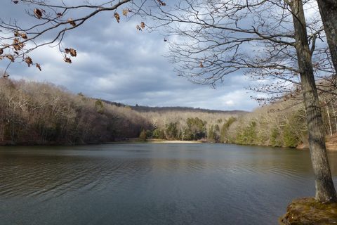
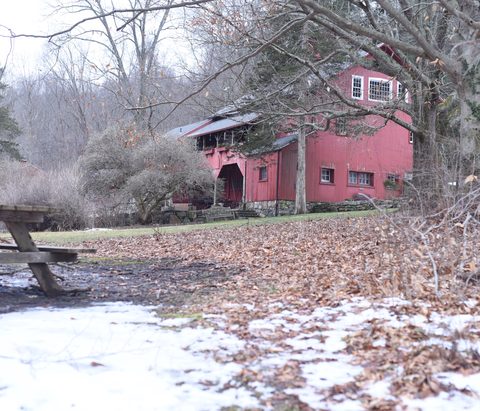
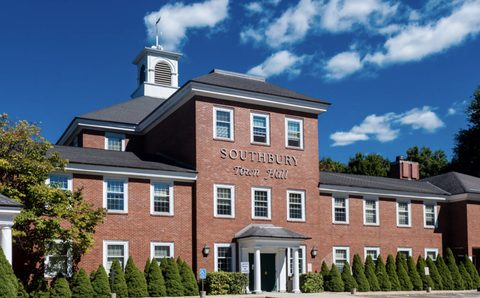
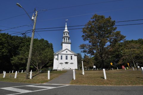
Southbury began in 1673, when religious dissidents from Stratford bought "Pomperaug Plantation" along a Housatonic tributary; the southern parish went its own way in 1787 with a charter as The Town of Southbury. What that history left behind is a town built for being outdoors: an Audubon sanctuary on a bend of the Pomperaug, a state park on Lake Zoar named for a one-kettle land deal, and a waterfall park with a covered bridge. Add a genuine resort-style hotel and a small, good restaurant row, and Southbury is the comfortable overnight in the region.
-
About 700 sanctuary acres left to Audubon for education by Althea Clark — trails open to the public since the early 2000s.
-
sight
605 acres on Lake Zoar with six-plus miles of trails. Day use is open; the campground is closed for the 2026 season after 2024 flood damage.
-
Tiered waterfall, covered bridge, observation tower, and a trout-stocked pond — on the old Diamond Match Company site.
-
sight
The Southbury Historical Society's anchor property in South Britain.
-
sight
A one-room schoolhouse run as a living museum.
-
food
The founding 1989 location of the family — and a 'Best Burrito in Connecticut' winner.
-
food
The big-menu Connecticut original's Southbury outpost — lobster roll and fish fry.
-
food
NYC-style cocktail lounge — espresso martinis and bao buns.
-
food
Family-owned Indian with near-perfect ratings. Closed Tuesdays.
-
The region's resort-style stay: saltwater pools, spa, athletic club, The Tavern, and nine holes of golf out back.
Pomperaug Plantation and the kettle legend
In 1673, religious dissidents from Stratford purchased Pomperaug Plantation and settled the valley; Southbury — originally Woodbury's southern parish — received its own town charter in 1787. During the Revolution the town supplied militia and provisions to Washington's forces. The land kept its stories: legend says colonists obtained the Kettletown tract from the Pootatuck people for a single brass kettle, and the original village site there disappeared under water in 1919 when damming the Housatonic created Lake Zoar. Colonial Revival photographer Wallace Nutting, a Southbury resident, immortalized the town in his 1923 "Connecticut Beautiful."
Know before you go
Kettletown's campground is closed for the 2026 season (2024 flood damage), though day use is open. And a note that saves confusion: Heritage Village, despite the name, is an age-restricted residential community — not a tourist attraction. The Heritage Hotel on Heritage Road is the place travelers actually want.
Frequently asked questions
- How did Kettletown get its name?
- Local legend says early colonists traded one brass kettle to the Pootatuck people for the right to hunt and fish the land.
- Is the Kettletown campground open?
- Not in 2026 — it's closed for the season due to August 2024 flood damage. The park itself is open for day use.
- What is Heritage Village?
- An age-restricted retirement community, not a tourist attraction. Travelers looking for 'Heritage' want the Heritage Hotel, Golf & Conference Center on Heritage Road.
- When did Southbury become a town?
- 1787, when Woodbury's southern parish received a charter as The Town of Southbury; European settlement of the valley dates to 1673.
- Where should I stay?
- The Heritage Hotel, Golf & Conference Center — Southbury's full-service resort-style hotel with pools, a spa, and golf.
Foliage
Still green this week · most advanced Oct 14–20
This town never reaches full colour on the state's map — DEEP's eight weeks run out before it turns.
On the Scenic Fairfield foliage driving route.
Derived from the Connecticut DEEP fall foliage map. DEEP's map is a climatological estimate last published in 2023; it describes a normal year, not this one. Stage names are ours. See the statewide forecast.
We can't find the internet
Attempting to reconnect
Something went wrong!
Hang in there while we get back on track
What travelers think
Connected pages
Nearby
- Danbury, Connecticut: Hat City History, Rail Heritage, and Where to Eat · Danbury, Connecticut
- Woodbury, Connecticut: Antiques Capital, the Glebe House, and Main Street · Woodbury, Connecticut
-
Middlebury, Connecticut: Quassy, the Greenway, and the Quiet Side of the Valley
· Middlebury, Connecticut
The two towns share a border
-
Bridgewater, Connecticut: The Last Dry Town on the Housatonic
· Bridgewater, Connecticut
The two towns share a border
-
Oxford, Connecticut: A Turnpike Town on the Housatonic
· Oxford, Connecticut
Oxford was incorporated in 1798 from parts of Southbury, and Southford Falls State Park straddles their shared border.
-
Newtown, Connecticut: Scrabble, a Flagpole and a Cultural District
· Newtown, Connecticut
The Newtown-Southbury boundary runs along the Housatonic River at the Rochambeau Bridge.
- Roxbury, Connecticut: Rocky Water and Mine Hill · Roxbury, Connecticut
Shared history
-
Middlebury, Connecticut: Quassy, the Greenway, and the Quiet Side of the Valley
· Middlebury, Connecticut
Middlebury (1807) was assembled partly from Southbury land.
-
Woodbury, Connecticut: Antiques Capital, the Glebe House, and Main Street
· Woodbury, Connecticut
Both grew from the 1673 Pomperaug Plantation; Southbury was Woodbury's southern parish until 1787.
Same region
- Danbury, Connecticut: Hat City History, Rail Heritage, and Where to Eat · Danbury, Connecticut
-
Newtown, Connecticut: Scrabble, a Flagpole and a Cultural District
· Newtown, Connecticut
Both on the Scenic Fairfield foliage route
-
Bethel, Connecticut: Barnum's Birthplace and a Vodka First
· Bethel, Connecticut
Both on the Scenic Fairfield foliage route
-
Woodbury, Connecticut: Antiques Capital, the Glebe House, and Main Street
· Woodbury, Connecticut
Both on the Scenic Fairfield foliage route
-
Roxbury, Connecticut: Rocky Water and Mine Hill
· Roxbury, Connecticut
Both on the Scenic Fairfield foliage route